布朗布朗 (城市) 目录 历史 地理 参考资料 外部链接 导航菜单46°33′N 6°31′E /...
沃州的市镇
瑞士联邦沃州镇莫尔日区沃诺日河
body.skin-minerva .mw-parser-output table.infobox caption{text-align:center}
布朗布朗 Bremblens | ||
|---|---|---|
| ||
 | ||
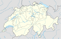 布朗布朗 布朗布朗在瑞士的位置 | ||
坐标:46°33′N 6°31′E / 46.550°N 6.517°E / 46.550; 6.517坐标:46°33′N 6°31′E / 46.550°N 6.517°E / 46.550; 6.517 | ||
| 國家 | ||
| 州 | 沃州 | |
| 区 | 莫尔日区 | |
| 语言 | 法语 | |
| 政府 | ||
| • 市長 | Eric Bühler | |
| 面积 | ||
| • 总计 | 2.90 平方公里(表达式错误:未预料的<操作符。 平方英里) | |
| 海拔 | 475 米(1,558 英尺) | |
| 人口 | ||
| • 總計 | 428 | |
| 时区 | CET (UTC+1) | |
| • 夏时制 | CEST(UTC+2) | |
| 郵政號碼 | 1121 | |

布朗布朗(法语:Bremblens)是瑞士联邦西部法语区的沃州下设的一个镇。在行政上属于莫尔日区管辖。布朗布朗的总面积为2.90平方公里。截至2007年,总人口为428。[1]
目录
1 历史
2 地理
3 参考资料
4 外部链接
历史
地理
东北以沃诺日河(la Venoge)为界。
参考资料
^ (法文)Bilan de la population résidante permanente (total) selon les districts et les communes 互联网档案馆的存檔,存档日期2016-03-24. 瑞士联邦统计局
外部链接
(法文)布朗布朗官方网站
| |||||||


